
resources
Unveiling the 10 Biggest States in the United States by Land Area
27 Jul 2025

When you think about the vastness of the United States, it’s easy to get lost in the sheer scale of it all. From coast to coast, there are so many different landscapes and places to see. But have you ever wondered which states take up the most room? We’re talking about the 10 biggest states in the United States by land area. It’s a pretty interesting list, and some of them are truly enormous.
Key Takeaways
- Alaska is by far the largest state in the U.S., covering more land than the next two largest states combined.
- Texas, the second-largest state, is a massive territory with a significant impact on the national landscape.
- Montana and New Mexico are the third and fourth largest, showcasing the expansive nature of the American West.
- Arizona, Nevada, and Colorado also rank high, highlighting the considerable landmass found in the southwestern United States.
- Oregon, Wyoming, and Michigan round out the top ten, each contributing a substantial amount of land to the country’s total area.
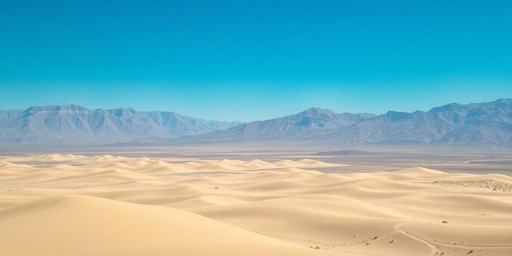
1. Alaska
When we talk about the biggest states in the U.S. by land area, Alaska is in a league of its own. It’s not just big; it’s enormous. Alaska’s sheer size dwarfs all other states, making it the undisputed champion of land area. Covering a massive 570,640.95 square miles, it’s more than twice the size of Texas and larger than California and Montana combined. To put that into perspective, you could fit more than seven United Kingdom’s within Alaska’s borders.
Land Area Comparison
Here’s a look at how Alaska stacks up against some other large states:
| State | Land Area (sq mi) |
|---|---|
| Alaska | 570,640.95 |
| Texas | 261,231.71 |
| Montana | 145,545.80 |
| New Mexico | 121,298.15 |
| Arizona | 113,594.08 |
Notable Features
Alaska’s vastness means it has incredibly diverse geography. From the towering peaks of Denali, the highest point in North America, to the extensive coastlines and icy glaciers, the landscape is truly wild. The state is also home to numerous active volcanoes, particularly in the Aleutian Islands chain. The largest population center is Anchorage, but even that metropolitan area is spread out across a significant amount of land.
The state’s remote location and harsh climate contribute to its low population density, with vast stretches of wilderness remaining largely untouched.
Key Facts
- Size: 570,640.95 sq mi (1,477,953.3 km²)
- Highest Point: Denali (formerly Mount McKinley) at 20,310 feet (6,190.5 m)
- Largest City: Anchorage
- Geographic Diversity: Includes mountains, glaciers, forests, and tundra.
2. Texas
Coming in at a massive 268,596 square miles, Texas is the second-largest state in the U.S. by land area. It’s a place with a lot of history and even more wide-open spaces. You might think of cowboys and oil rigs, and sure, that’s part of it, but Texas is also a major player in many other areas. Its size means it has incredibly diverse geography, from the piney woods in the east to the desert landscapes in the west.
Key Facts About Texas:
- Size: 268,596 square miles (695,662 square kilometers).
- Rank: Second largest state by land area.
- Nickname: The Lone Star State.
- Bordering States: Oklahoma, Arkansas, Louisiana, and New Mexico.
Historical Significance:
Texas has a unique history, having been an independent republic before joining the United States in 1845. This period as the Republic of Texas left a lasting mark on its culture and identity. The state’s expansion and development were significantly shaped by events like the Mexican–American War, which solidified its borders. The annexation of Texas was a major event in U.S. history.
The sheer scale of Texas means that traveling across it can feel like crossing multiple states. You’ll find everything from bustling major cities like Houston and Dallas to vast ranches and rugged coastlines along the Gulf of Mexico. It’s a state that truly embodies the idea of ‘everything’s bigger in Texas.’
Texas’s Diverse Landscapes:
Texas isn’t just flat plains. Its geography is surprisingly varied:
- Gulf Coast: Long stretches of beaches and bayous.
- East Texas: Known for its pine forests.
- Central Texas: Rolling hills and the state capital, Austin.
- West Texas: Arid deserts and the Guadalupe Mountains.
- The Panhandle: High plains that stretch towards Oklahoma.
3. Montana
Montana, often called the "Big Sky Country," is a state that truly lives up to its nickname. It’s the fourth largest state in the U.S. by land area, covering a massive 145,545.80 square miles. That’s a lot of wide-open spaces! This vastness means you’ll find incredibly diverse landscapes, from the rugged peaks of the Rocky Mountains in the west to the rolling plains that stretch eastward. It’s a place where nature really takes center stage.
Geography and Landscape
Montana’s geography is dominated by mountains and plains. The western part of the state is part of the Rocky Mountains, featuring stunning national parks like Glacier National Park and areas known for their dramatic scenery and outdoor activities. As you move east, the terrain transitions into the Great Plains, characterized by grasslands and a more arid climate. This contrast makes Montana a visually striking state.
Population Density
Given its enormous size, Montana has one of the lowest population densities in the United States. With a population of around 1.1 million people spread across its vast territory, you can imagine how much room there is to roam. The average population density is about 7 people per square mile, which really highlights the state’s rural character and abundant open land. This low density contributes to its reputation for solitude and natural beauty.
Key Facts
- Total Area: 145,545.80 sq mi (376,961.9 km²)
- Population (approximate): 1,084,225
- Population Density: 7/sq mi (3/km²)
- Major Mountain Ranges: Rocky Mountains
- Eastern Terrain: Great Plains
Montana’s sheer size means that getting from one side of the state to the other can be quite a journey. It’s a place that encourages exploration and appreciating the scale of the American West. You can find great beef here, raised on those wide-open ranches.
Notable Features
Montana is famous for its natural beauty and outdoor recreation opportunities. Hiking, fishing, camping, and wildlife viewing are popular activities. The state is home to a significant amount of wildlife, including grizzly bears, elk, and bison. Its rugged terrain and relatively untouched wilderness make it a draw for those seeking an escape into nature. The state is part of the Mountain States subregion, known for its unique cultures and balance between development and environment.
4. New Mexico
Land Area and Geography
New Mexico, often called the "Land of Enchantment," holds the fifth spot on our list of the largest states by land area. It covers a vast expanse of 121,298 square miles. This state is known for its distinctive high-desert terrain, a landscape that beautifully marries ancient adobe pueblos with unique desert ecosystems. You’ll find a variety of environments here, from arid plains to mountainous regions.
Historical Context
Following the Mexican-American War, Mexico officially recognized U.S. ownership of territories including New Mexico in 1848. This significant land transfer, known as the Mexican Cession, also included areas that would later become other western states. The discovery of gold in California shortly after this period led to a massive influx of settlers, dramatically changing the demographic and political landscape of the West.
Key Facts about New Mexico
- Nickname: The "Land of Enchantment"
- Rank by Land Area: 5th largest in the U.S.
- Total Land Area: 121,298 square miles
- Notable Features: High-desert landscapes, adobe architecture, diverse ecosystems.
New Mexico’s unique geography and rich history have shaped its identity, making it a fascinating place to explore. The state’s cultural heritage is deeply rooted in its Native American and Spanish colonial past, evident in its art, architecture, and traditions.
Cultural Significance
New Mexico is also recognized as the "Chile Capital of the World." The state’s agricultural sector, particularly its cultivation of chile peppers, is a significant part of its economy and cultural identity. Institutions like the Chile Pepper Institute at New Mexico State University further highlight this connection, celebrating and researching this iconic crop.
5. Arizona
Next up on our list is Arizona, a state known for its stunning desert landscapes and vibrant cities. It covers a total area of 113,998 square miles, making it the sixth-largest state in the U.S. by land area.
Arizona’s geography is quite varied. While much of the state is desert, it also features mountains, forests, and canyons. The Grand Canyon, one of the most famous natural wonders in the world, is located here.
Key Facts about Arizona:
- Population: As of recent estimates, Arizona’s population is over 7 million people.
- Largest City: Phoenix is the capital and largest city, also serving as a major economic hub.
- Nickname: The state is often called the "Grand Canyon State."
Arizona’s Land Area Breakdown:
Arizona’s total land area is impressive, contributing significantly to its ranking.
| Category | Size (sq mi) | Size (sq km) |
|---|---|---|
| Total Area | 113,998 | 294,207 |
| Land Area | 113,594 | 294,207 |
| Water Area | 404 | 1,046 |
Arizona’s vastness means it holds a diverse range of climates and ecosystems, from the hot Sonoran Desert to cooler, higher-elevation forests. This variety supports a wide array of plant and animal life.
When people think of Arizona, they often picture the iconic saguaro cactus. But the state’s size means there’s much more to explore, from the red rocks of Sedona to the historic mining towns scattered throughout the state. The population density is around 63 people per square mile, showing how much open space there is. The Phoenix-Mesa-Chandler MSA is a major metropolitan area within the state.
6. Nevada
Coming in at number six on our list of the biggest states by land area is Nevada. This Western state covers a massive amount of territory, much of which is arid desert landscape. It’s a place known for its wide-open spaces and, of course, its famous entertainment hubs.
Land Area and Population
Nevada spans an impressive 109,781.18 square miles, making it a significant player in terms of sheer size. However, its population density is quite low, with only about 28 people per square mile. This means there’s a lot of room to roam.
Key Facts about Nevada
- Nickname: The Silver State
- Capital: Carson City
- Largest City: Las Vegas
- Statehood: 36th state, admitted October 31, 1864
Nevada’s Unique Landscape
Much of Nevada’s terrain is characterized by the Great Basin Desert, which features a series of north-south mountain ranges separated by flat valleys. You’ll also find the Mojave Desert in the southern part of the state. Despite the arid conditions, Nevada is home to diverse ecosystems and unique geological formations.
Nevada’s vastness means that while major cities like Las Vegas are densely populated, large portions of the state are sparsely inhabited, offering a stark contrast between urban energy and remote wilderness.
Nevada is ranked 34th overall among U.S. states, based on various metrics. The state’s economy has historically been tied to mining, particularly silver, but tourism and entertainment have become major drivers, especially in the Las Vegas area. Exploring the natural beauty of Nevada can be a rewarding experience for those who appreciate its rugged charm.
7. Colorado
Coming in at number seven on our list of the largest states by land area is Colorado. This Rocky Mountain state covers a significant chunk of the American West, boasting a total area of 104,094 square miles. That’s a lot of ground to cover!
Colorado’s landscape is incredibly diverse, ranging from the high plains in the east to the majestic Rocky Mountains that dominate its western half. It’s a state known for its stunning natural beauty and outdoor recreation opportunities. Think skiing, hiking, and just generally enjoying the wide-open spaces.
Here’s a quick look at some key figures for Colorado:
- Total Area: 104,094 square miles (269,601 square kilometers)
- Rank by Area: 7th largest in the U.S.
- Land Area: 103,641.89 square miles (268,431.3 square kilometers)
Colorado is one of the Mountain States, a region known for its rugged terrain and significant elevation changes. The state’s highest point, Mount Elbert, stands at 14,440 feet above sea level, making it the highest summit in the Rockies.
When you compare it to other states, Colorado is quite substantial. For instance, it’s roughly equivalent in size to the United Kingdom, or a bit larger than the U.S. state of Oregon. It’s a place where you can really feel the vastness of the American landscape. If you’re interested in learning more about the largest states in the United States, Colorado is definitely a state worth noting.
8. Oregon
Coming in at number eight on our list of the largest states by land area is Oregon. This Pacific Northwest state covers a total area of 98,379 square miles, which is pretty substantial when you think about it. It’s a bit larger than the United Kingdom, for comparison.
Oregon’s landscape is incredibly diverse. You’ve got the rugged coastline along the Pacific Ocean, the lush forests of the Coast Range and the Willamette Valley, and then the drier, high desert terrain east of the Cascade Mountains. The Cascades themselves are home to Mount Hood, the state’s highest peak, which is actually a dormant volcano.
Here’s a quick look at some key figures for Oregon:
- Total Area: 98,379 sq mi (403,466.3 km²)
- Population (approximate): 4.2 million
- Largest City: Portland
The state is known for its natural beauty, from Crater Lake National Park, which holds the deepest lake in the United States, to the Columbia River Gorge, famous for its waterfalls.
When people think of Oregon, they often picture its green forests and rainy climate, especially in the western part of the state. However, the eastern side is quite different, with more sunshine and a drier climate, supporting different types of plant and animal life. This variety makes Oregon a really interesting place, both geographically and ecologically. It’s a state that really showcases the varied landscapes the United States has to offer, from coastal beauty to mountain grandeur and high desert plains. The Portland-Vancouver-Hillsboro MSA is a significant population center within the state.
9. Wyoming
Coming in at number nine on our list of the largest states by land area is Wyoming. This state, located in the western United States, covers a significant amount of territory. It’s known for its wide-open spaces and stunning natural beauty, much of which is preserved in its national parks and forests.
Wyoming’s land area is impressive, making it a key player in the vastness of the American landscape. When you think of wide-open spaces, Wyoming often comes to mind. It’s a place where you can really feel the scale of the country.
Key Facts about Wyoming’s Land Area
- Total Area: Wyoming spans approximately 97,093 square miles.
- Land Area: The majority of this is land, measuring around 93,079 square miles.
- Water Area: The remaining portion is water, covering about 4,014 square miles.
Wyoming’s Place in the U.S.
Wyoming is a state that truly embodies the spirit of the American West. Its relatively low population density means that much of its land remains undeveloped, offering a sense of solitude and connection to nature that’s hard to find elsewhere. The state’s geography is diverse, featuring mountains, plains, and high desert.
Wyoming’s vastness contributes to its unique character, offering a stark contrast to more densely populated regions. It’s a state where nature often takes center stage.
When comparing it to other states, Wyoming’s size is notable. For instance, it’s considerably larger than many eastern states but still significantly smaller than the top contenders like Alaska and Texas. Its position at number nine highlights the sheer scale of some of the western states. If you’re interested in the geography of the United States, understanding the land area of states like Wyoming provides important context.
10. Michigan
Michigan might not be the biggest state when you only look at its dry land, but it’s a different story when you consider its water territory. This state has a massive amount of its total area covered by the Great Lakes. This makes it quite unique in how we measure its size.
Great Lakes Influence
When we talk about the biggest states by land area, we usually mean just the ground you can walk on. But for Michigan, a big chunk of its reported size comes from the water within its borders. This includes large parts of Lake Superior, Lake Michigan, Lake Huron, and Lake Erie. It’s kind of like how Alaska has a lot of land, but Michigan has a lot of water that counts towards its total area.
Size Comparison
Here’s how Michigan stacks up in terms of its total area, including the water:
| State | Total Area (sq mi) |
|---|---|
| Michigan | 96,716 |
This figure places Michigan as the 10th largest state in the U.S. when you include its significant water surface. It’s a good reminder that how we measure things can really change the outcome.
Interesting Facts
- Michigan is made up of two peninsulas: the Lower Peninsula and the Upper Peninsula.
- It has the longest freshwater coastline of any U.S. state.
- The state is a major hub for the automotive industry, often called the "Motor City."
The inclusion of Great Lakes waters significantly boosts Michigan’s ranking in total area, highlighting the importance of considering all geographical components when comparing state sizes. It’s a fascinating aspect of American geography.
Wrapping Up Our Look at America’s Largest States
So, there you have it – the top 10 largest states in the U.S. by land area. It’s pretty wild to think about how much space these places cover, right? From the vastness of Alaska to the sprawling landscapes of Texas and beyond, these states really show off the sheer scale of the country. It makes you appreciate the diverse geography the United States has to offer. Maybe this has sparked some interest in exploring these massive areas yourself, or perhaps just given you a new appreciation for geography class. Either way, understanding these differences in size helps paint a clearer picture of the American landscape.
Frequently Asked Questions
Which U.S. state is the largest by land area?
Alaska is the biggest state in the U.S. by a lot! It’s much larger than any other state, covering a huge amount of land.
What’s the second-largest state in the U.S.?
Texas is the second-largest state. It’s known for being really big and having lots of space.
How big is Montana compared to other states?
Montana is the third-largest state. It’s a big place with wide-open areas and beautiful nature.
Is New Mexico one of the biggest states?
New Mexico is the fourth-largest state. It has a lot of land, known for its deserts and mountains.
What makes Arizona a large state?
Arizona is the fifth-largest state. It’s famous for the Grand Canyon, which shows how vast the state is.
What are the other large states in the top 10?
Nevada, Colorado, Oregon, Wyoming, and Michigan are also among the top 10 largest states. They all have significant land areas, offering diverse landscapes from mountains to plains.


